A trip to Wapahaśa’s Prairie

On Friday, September 14, 2012, Gwen Westerman and Bruce White spoke before an audience at the Bookshelf, an attractive bookstore combined with a cafe, close to the Mississippi River in the city of Winona. This city is the location of one of the village sites occupied by the Kiyuksa band of Dakota under the leadership of the series of Dakota chiefs known as Wapahaśa, or Wabasha.
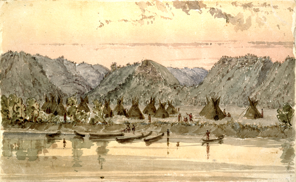
A view of “Wabashaw’s Prairie” by artist Seth East, around 1847, look from the Mississippi River toward the nearby hills. The original is in the Minnesota Historical Society.

Among those in the audience were a group from Rochester, Minnesota, who are supporters of the preservation of Indian Heights Park, a beautiful park along the Wazi Oźu Wakpa, now known as the Zumbro River, which is the recorded location of Dakota burials dating as late as the 1850s. Their presence brought to mind a story recorded about Winona in Chapter 3 of our book (page 131) about how the grave sites of members of Wapahasa’s band were protected by early settlers of the city. The following account is one we quoted from an early history of Winona County. It ought to be an inspiration to people today, to protect the burial sites–and the ancient cultural sites–of the Dakota which still exist all over the region of Mni Sota Makoce today.

Quite a number of Indian graves were on these grounds. Nearly in front of the farmhouse there were two or three graves of more modern burial lying side by side. These were said to be the last resting-place of some of Wabasha’s relatives. The Sioux made a special request of Mr. Burns and his family that these graves should not be disturbed. This Mr. Burns promised, and the little mounds, covered with billets of wood, were never molested, although they were in his garden and not far from his house. For many years they remained as they were left by the Indians, until the wood by which they were covered rotted away entirely. A light frame or fence of poles put there by Mr. Burns always covered the locality during his lifetime.
The book is out!

At a gathering sponsored by Birchbark Books, on the evening of September 13, 2012, at St. Paul’s Episcopal Church, on Logan Avenue in Minneapolis, the authors of and some of the contributors to Mni Sota Makoce: The Land of the Dakota spoke about the experience of working on the book over the last four-and-a-half years. Afterwards, we signed books and talked to all the great people who came to see us.  Each of us spoke about the project from our own particular perspective, as we did in project meetings over the last few years. Kate Beane, for example noted that the phrases “reading between the lines of the historical record,” which is part of the title of Chapter 2 in the book, ought to read “reading between the lies,” because of the questionable nature of some of the information that was recorded in European sources about the Dakota. It was part of the challenge of working on this book to sort out the lies from the truth.

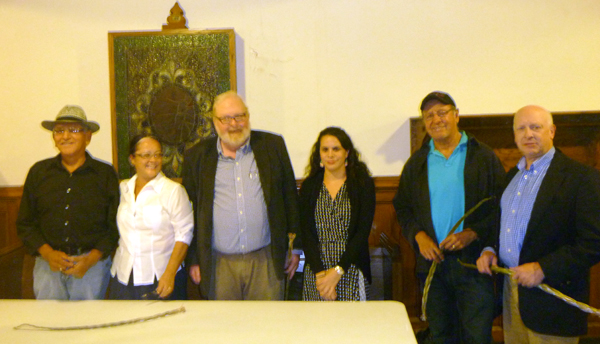
Many of those who contributed to the book gathered at St. Paul’s Episcopal Church on September 13, 2012, including, from left to right, Glenn Wasicuna, Gwen Westerman, Bruce White, Kate Beane, Syd Beane, and Thomas Shaw.

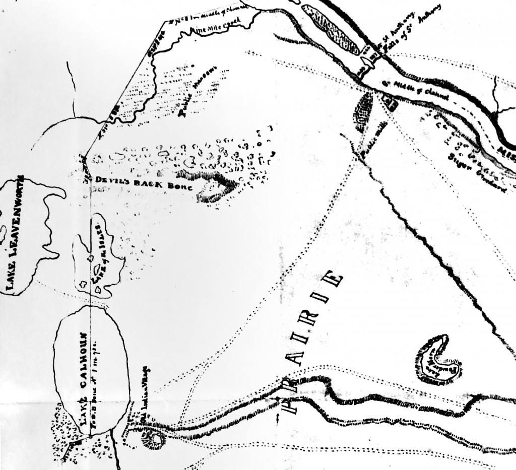
In was interesting to be at this church, across the street from Lake of the Isles, one of the lakes that line the western edge of Minneapolis and also mark the western boundary of the Fort Snelling Reservation, which was created under the dubious Treaty of 1805, which led to the construction of Fort Snelling starting in 1820. Under that treaty as we talk about in the book the Dakota people were reserved the right to to “pass, repass, hunt or make other uses of the said districts, as they have formerly done.” It was not until the 1830s that the boundaries of the Fort Snelling Reservation were defined to include almost all of present-day Minneapolis, parts of St. Paul and Mendota Heights. Among the few places still in federal hands as a result of that treaty is Coldwater Spring, where the right of the Dakota  “to pass, repass, hunt or make other uses of the said districts, as they have formerly done” is still contested.

A portion of a map first drafted in 1839 by Lieutenant James Thompson, showing the northwestern part of the Fort Snelling Reservation including Lake Calhoun, Lake of the Isles, and Lake Leavenworth, now Cedar Lake. The formation called the Devil’s Backbone is now called Lowry Hill.